Our Services
GIS Services
AGSS provide excellent geo spatial services to your organization. We give our best technology and services for improving your department requirement to update your infrastructure mapping; a county assessor is looking for a professional to maintain data.
Remote Sensing Services
AGSS services carry out the processing of raw satellite images, image rectification, classification, subset, mosaic, geo-referencing, change detection analysis for various images and for specific applications such as forest monitoring, drought analysis, slope analysis, mining and geology mapping, watershed management, urban planning and natural hazard analysis.
Utilities Services
Utility sector is one of the expanding sectors. The utility management is one of basic need of the modern infrastructure management. Components of utility should be functional without any breakdown and it is very difficult to manage manually, so geographic data provides spatial dimensions to its management.
CAD Services
AGSS provides in the domain of civil, structural, electrical, mechanical and all other engineering lines. We have access to a wide pool of talent that enables to provide high quality services, time bound and cost effective CAD services.
Survey/GPS/DGPS work
AGSS provides DGPS survey for accuracy up to mm, for horizontal X, Y coordinates as well as Z value also. The DGPS survey allows capturing of geographic coordinates values in the World Geodetic System 1984, or any other projection, for seamless integration to a Geographic Information System.
WebGIS & Customization
Web GIS has made it very easier to share spatial data over World Wide Web and it can be accessed by any user in any corner of the world without having any special GIS software loaded on his machine.
Android Application GIS
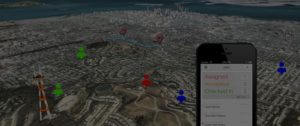
AGSS offer cloud mobile data collection for Android and IOS devices. Mobile Data Collection is a few taps of the finger and you have media enriched location information available from anywhere. Open Data Kit (ODK) is a suite of tools to help organizations collect, aggregate and visualizes their data.


